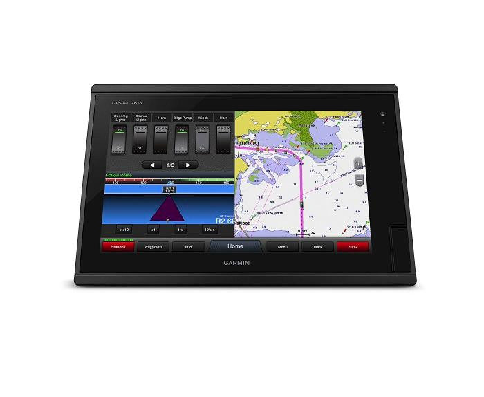
Garmin GPSMAP7616 Chartplotter Bluechart G2 & Lakevu HD US
Garmin GPSMAP 7616 16-inch Fully-network Capable Chartplotter
Model: 010-01402-11UPC: 753759159122
- 16-inch multi-touch widescreen display (1366x768 WXGA) preloaded with both BlueChart® g2 and LakeVü™ HD coastal maps
- High-sensitivity internal 10 Hz GPS/GLONASS
- Fully network capable for Garmin Marine Network and NMEA 2000®, plus NMEA 0183 support
- Supports premium GSD™ sonar module and GCV™ scanning sonar module
- Advanced sailing and sail racing features
- J1939 port provides dedcated CAN port for receiving engine data.
Designed for cruisers, sailors and sailing racers who demand high performance, ease of operation, and feature integration. The GPSMAP 7616 chartplotter with 16-inch multi-touch widescreen display has a 10 Hz internal GPS that updates position and heading 10 times per second. Its fully network capable, including Garmin Network and NMEA 2000 (radar, autopilot, instruments, multiple screens, FUSION-Link, sensors, black box sonar, digital switching, thermal cameras, GRID and more). It also offers the conveniences of built-in Wi-Fi® connectivity.
Garmin Marine Network and NMEA 2000 SupportFull-network compatibility allows you to add more to your boat. GPSMAP 7616 supports radar, autopilot, instruments, multiple screens, FUSION-Link, sensors, remote sonar modules, digital switching, thermal cameras, GRID™ and more.
Add Array or Dome RadarYou can add your choice of Garmin marine radar, including our powerful xHD2 open array radars or xHD dome radars that pair ease of use with advanced open array features.
Network SharingGPSMAP 7616 allows you to share features with other compatible GPSMAP units, such as radar, supplemental maps and user data, including waypoints, routes and tracks. User data entered into 1 chartplotter can be automatically synced with other chartplotters in a network.
Heading, Position Refreshed 10 Times per SecondFast, responsive 10 Hz GPS/GLONASS refreshes your position and heading 10 times each second to make your movement on the screen more fluid. It makes dropping up to 5,000 accurate waypoints and finding your way back them quick and easy.
Special Sailing FeaturesSupported sailing features include laylines, enhanced wind rose, heading and course-over-ground lines, true wind data fields and tide/current/time slider. Racing features include pre-race guidance, synchronized race timer, virtual starting line, time to burn and lay line data fields. Gauge displays are designed to provide important need-to-know information at a glance, including true and apparent wind angle, set and drift, true or apparent wind speed, horizontal or vertical graphs, and a data bar with customizable data fields.
Preloaded BlueChart g2 MapsIn addition to the basic charts, tidal stations, currents, depth contours, IALA symbols and included fishing charts, BlueChart g2 offers smooth transitioning between zoom levels and more seamless continuity across chart boundaries. You can customize your screens with Safety Shading which allows you to contour shade for all depth contours shallower than what you determine is your safe depth. Fishing charts emphasize bathymetric contours with less visual clutter on the display. And there’s also a choice of standard 2-D direct overhead or 3-D ?over-the-bow? map views for easier chart reading and orientation.
Preloaded LakeVü HD MapsThese highly detailed freshwater maps include 17,000+ U.S. lakes, rivers and reservoirs. Included in those are more than 5,700 HD lakes with 1-foot contours shoreline to shoreline; excellent detail of underwater features plus Safety Shading that allows you to designate a minimum depth; interstates, highways, general roads and bridges; designated fishing areas; and points of interest, such as docks, boat ramps, marinas and campgrounds.
Upgrade to our Best Maps on the WaterTwo SD™ card slots provide expandable memory for accessory map purchases such as LakeVü HD Ultra with MaxDef Lakes or BlueChart g2 Vision® that add Garmin patented Auto Guidance and other great features.
GND™ 10 Black Box InterfaceThe GND 10 black box interface seamlessly integrates Nexus instruments and sensors with the Garmin family. It converts data between the Nexus network and NMEA 2000 to provide trouble-free compatibility between Nexus and Garmin products, including gWind™ and gWind Race transducers.
Compatible with gWind TransducersgWind, gWind Wireless and gWind Race transducers feature twin-fin technology with 3-bladed propeller. Connect to the NMEA 2000 and compatible Garmin chartplotters via the GND 10 black box bridge.
FUSION-Link Entertainment SystemEnjoy the ability to control all compatible FUSION-Link-enabled audio systems directly from your compatible chartplotter display.
Built-in Wi-Fi/ANTBuilt-in Wi-Fi/ANT® for use with Garmin Helm™ and BlueChart® Mobile.
View, Control Your Device from a Smartphone or TabletGarmin Helm allows you to view and control your compatible chartplotter from a compatible smartphone or tablet while providing enhanced situational awareness for the mariner. Easily switch between portrait and landscape mode to accommodate mounting preferences. When using an iPhone® or iPad®, you can even record a movie of your chartplotter screen to share with friends and family.
Get Onboard with BlueChart MobileWith BlueChart Mobile 2.0, a free app downloaded from the App Store™, you can get reliable weather information while you plan marine routes on your iPad or iPhone then wirelessly transfer them to your boat’s compatible networked Garmin chartplotter. Continue acquire current weather information from your cellular-based Apple® device and stream that data onto your chartplotter screen. Even if you don’t have a Garmin chartplotter, you can still take advantage of the tremendous features of BlueChart Mobile on your compatible Apple device.
iPhone and iPad are trademarks of Apple Inc., registered in the U.S. and other countries. App Store is a service mark of Apple Inc. Android and Google Play are trademarks of Google Inc. Wi-Fi is a registered trademark of the Wi-Fi Alliance.
Specifications| Physical & Performance | |
| Physical dimensions | 16.8"" x 10.8"" x 3.4"" (42.7 x 27.4 x 8.6 cm) |
| Display size | 13.6"" x 7.6""; 15.6"" diagonal |
| Display Resolution | 1366 x 768 pixels |
| Display Type | WXGA |
| Water rating | IPX7 |
| Antenna | Internal with external connection |
| NMEA 2000® compatible | Yes |
| NMEA 0183 compatible | Yes |
| SiriusXM™ Weather & Radio compatible | Yes |
| Power consumption | Max power usage at 10 Vdc: 57.2 W Typical current draw at 12 Vdc: 3.8 A Max current draw at 12 Vdc: 5.2 A |
| Mounting options | Flat and flush, bail with optional accessory |
| Garmin Marine Network™ ports | 2 |
| Maps & Memory | |
| Preloaded maps | BlueChart® g2 (coastal maps) and LakeVü HD (inland maps) |
| Accepts data cards | 2 SD™ cards |
| Waypoints | 5,000 |
| Routes | 100 |
| Track log | 50,000 points; 50 saved tracks |
| Chart plotter Features | |
| Garmin Radar compatible | Yes |
| Garmin Sonar compatible | Yes (when connected to another compatible sonar device) |
| Garmin SmartMode compatible (customizable monitor presets) | Yes |
| Supports AIS (tracks target ships position) | Yes |
| Supports DSC (displays position data from DSC-capable VHF radio) | Yes |
| Tide tables | Yes |
| Supports Fusion-Link compatible marine radios | Yes |
| GSD™ Black Box sonar support | Yes |
| GCV™ Black Box sonar support | Yes |
| BlueChart® Mobile (planning) compatible | Yes |
| Garmin Helm compatible | Yes |
| GRID™ (Garmin Remote Input Device) compatible | Yes |
| Wireless remote compatible | Yes |
| Sonar Features & Specifications | |
| Dual-frequency (50/200 kHz) sonar capable | Yes (when connected to another compatible sonar device) |
| Dual-beam (77/200 kHz) sonar capable | Yes (when connected to another compatible sonar device) |
| CHIRP sonar technology | Yes (when connected to another compatible sonar device) |
| DownVü™ | Yes (when connected to another compatible sonar device) |
| SideVü™ | Yes (when connected to another compatible sonar device) |
| Connections | |
| NMEA 0183 input ports | 2 |
| NMEA 0183 output ports | 2 |
| Video input ports | 2 Composite |
| Video output ports | 1 DVI-D |
| Wireless connectivity | Yes |
| Additional Features | |
| User Interface | Multi-touch touchscreen |
| Auto backlight dimming | Yes |
| Supplemental map share | Yes |
| Internal sonar sharing | Yes, receive only |
What's in the Box:
- GPSMAP 7616 preloaded with BlueChart® g2 and LakeVü HD coastal maps
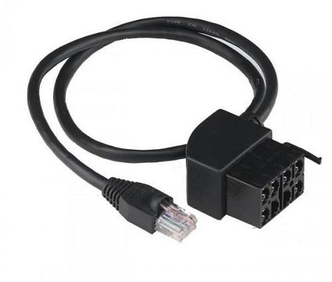
- Power/data cable
- NMEA 2000® drop cable
- T-connector
- Flush mount kit
- Protective cover
- Documentation