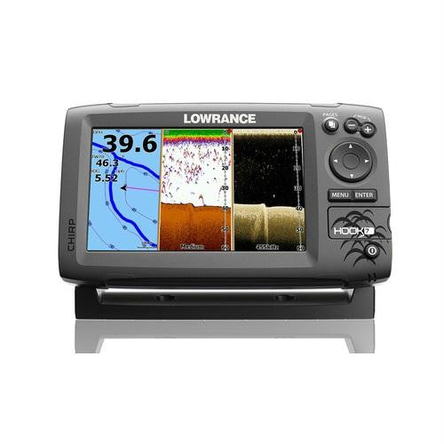
Lowrance HOOK7 7"" Combo Basemap No Transducer
Lowrance Hook7 7"" Fishfinder GPS Basemap No Transducer
Model: 000-12663-001UPC: 9420024146637
- Lowrance-exclusive, brilliant, high-resolution, 7-inch, color display
- CHIRP Sonar plus DownScan Imaging™ -- the power of today’s leading fishfinder technologies combined to provide the best possible view beneath your boat.
- Highly accurate, built-in GPS antenna plus a detailed U.S. map featuring more than 3,000 lakes and rivers and coastal contours to 1,000 feet.
- Optional Americas chart upgrades include Lake Insight™ and Nautic Insight™ PRO and HD, Navionics HotMaps® Premium and Fishing Hotspots® PRO. Global chart upgrade options include Navionics + and Jeppesen C-MAP MAX-N.
- Use your Insight Genesis™ custom maps created from your own sonar logs.
- DownScan Overlay™ technology overlays DownScan Imaging onto CHIRP Sonar.
- Advanced Signal Processing (ASP) reduces the need to manually adjust settings to see fish, structure and bottom detail more clearly.
- TrackBack™ to review recorded sonar history including structure, transitions or fish targets, then pinpoint locations with a waypoint.
- Convenient Page selector menu with quick access to all features using one-thumb operation.
- Multi-Window Display lets you quickly choose from pre-set page layouts - including a three-panel view.
The Hook-7 combines the benefits of CHIRP Sonar and DownScan Imaging™ technology to give you a clear and complete view of the underwater environment beneath your boat. It features enhanced sonar sensitivity, excellent target separation and superior noise rejection, making it easier to see baitfish and gamefish targets. With a built-in GPS antenna and proven navigation features, revisiting your favorite fishing spot is simple with the Hook-7, whether you use the base map, optional high definition chart upgrades, or your own Insight Genesis custom maps.
Specifications| Display Size | 7"" |
| Display type | 16-bit color SolarMAX™ PLUS TFT |
| Display resolution | 800 x 480 |
| backlighting | Adjustable LED |
| Power output | 500w RMS |
| Operating frequencies | 455/800 kHz (DownScan Imaging™), Mid, High (CHIRP), 83kHz/200kHz |
| Media port | microSD x 1 |
| Networking | NMEA0183 |
| maximum depth | DownScan Imaging™ at 455 kHz: Max 300 ft / 91 m CHIRP Sonar High Range/200 kHz: 1,000 ft / 305 m CHIRP Sonar Med Range/83 kHz: 1000 ft / 305 m |
| Depth Alarm | Yes |
| Shallow alarm | Yes |
| Temperature readings | Yes |
| Routes | 100 |
| Waypoints | 3000 |
| Plot trails | Up to 100 trails - up to 10,000 points/trail |
| GPS antenna type | Internal high-sensitivity WAAS + EGNOS + MSAS |
| GPS alarms | Yes |
| Custom mapping | Optional Americas chart upgrades include Lake Insight™ and Nautic Insight™ PRO, Navionics HotMaps® Premium and Fishing Hotspots® PRO. Global chart upgrade options include Navionics + and Jeppesen C-MAP MAX-N |
| Basemap | World reference basemap plus over 3,000 enhanced U.S. lake maps with depth contour and shoreline detail, and U.S. coastal depth contours/shoreline detail and spot depth soundings to 1,000 ft /305 m |
| Dimensions | 5.95"" H x 9.26"" W x 3.0 D |
What's in the Box:
- Hook7
- bracket
- Knobs
- Powercord
- Documentation