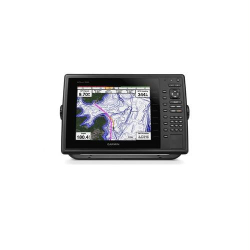
Garmin GPSMAP1020 10"" Plotter Worldwide Basemap
- 10" color SVGA display with keyed control
- Preloaded with worldwide basemap
- High-sensitivity internal 10 Hz GPS/GLONASS receiver
- Compatible with LakeVü;™ HD Ultra, BlueChart® g2 and BlueChart g2 Vision®
- Supports all Garmin marine radar
The 10" color GPSMAP 820 keyed chartplotter has a preloaded worldwide basemap. The built-in 10 Hz GPS/GLONASS receiver updates your position and heading 10 times per second.
With NMEA 2000® support for autopilot capability, engine data, SiriusXM® Weather and more, the GPSMAP 820 is compatible with LakeVü; HD Ultra, BlueChart g2 and BlueChart g2 Vision. It also supports all Garmin marine radar.
For even more functionality, wirelessly connect to Apple® (mobile digital device) for BlueChart® Mobile. The chartplotter includes 2 SD™ data card slots, allowing for gigabytes of storage. It can be flat, flush or bail mounted.
NetworkingThe GPSMAP 820xs offers select networking capabilities that allow you to share features with other compatible GPSMAP units, such as radar, GCV 10 DownVü; and SideVü; scanning sonar, supplemental maps, and user data, such as waypoints, routes and tracks.
Special Sailing FeaturesSupported sailing features include laylines, enhanced wind rose, heading and course-over-ground lines, and true wind data fields.
| Physical & Performance | |
| Unit dimensions, WxHxD | 14.1" x 9.3" x 2.9 " (35.9 x 23.6 x 7.5 cm) |
| Display size, WxH | 8.3" x 6.2", 10.4" diagonal (21.1 x 15.8 cm, 26.4 cm diagonal) |
| Display resolution, WxH | 800 x 600 pixels |
| Display type | SVGA display |
| Weight | 4.7 lb (2.1 kg) |
| Battery | none |
| Battery life | none |
| Waterproof | Yes (IPX7) |
| High-sensitivity receiver | Yes |
| Antenna | internal |
| NMEA input/output | NMEA 0183 compatible and NMEA 2000® certified |
| Maps & Memory | |
| Basemap | Yes |
| Preloaded maps | No |
| Ability to add maps | Yes (via SD card) |
| Built-in memory | none (cannot load maps to internal memory) |
| Waypoints/favorites/locations | 5,000 |
| Routes | 100 |
| Track log | 50,000 points; 50 saved tracks |
| Features & Benefits | |
| Radar compatible | Yes |
| Sonar Compatible | Yes (with optional GCV 10) |
| Garmin Marine Network™ compatible | Yes (select features) |
| Touchscreen | No |
| Supports AIS (tracks target ships' position) | Yes |
| Supports DSC (displays position data from DSC capable VHF radio) | Yes |
| Audible alarms | Yes |
| Tide tables | Yes |
| Hunt/fish calendar | No |
| Sun and moon information | Yes |
| 3-D map view | Yes (with optional BlueChart g2 Vision card) |
| Auto Guidance | Yes (with optional BlueChart g2 Vision card) |
| SiriusXM® Weather and Radio compatible | Yes |
| Automatic routing (turn by turn routing on roads) | No |
| Voice prompts (e.g. "Turn right in 500 ft.") | No |
| Speaks street names (e.g. "Turn right ON ELM STREET in 500 ft.") | No |
| Headphone jack/audio line-out | No |
| Audio/video input/output | No |
| Portable | No |
| Automotive/motorcycle-friendly | No |
| Additional | Garmin Helm: yes Wireless connectivity: yes GCV 10 compatible: yes |
In the Box
- GPSMAP 1020 with worldwide basemap
- Power/data cable
- Bail mount
- Flush mount
- Protective cover
- Documentation